The Command Center for Oklahoma Mineral Owners
Monitor. Analyze. Automate. OCC alerts, production intelligence, AI document extraction, and interactive mapping — all in one platform.
Start Today
Track your first property completely free. No credit card required.
Start Free Compare all plans →Finally, Everything in One Place
Stop juggling spreadsheets and OCC searches. We bring it all together — and county records too, with Professional.
OCC Docket Monitoring
Pooling orders, spacing cases, increased density applications — we monitor 8 filing types and alert you when your sections are involved.
Area Activity
Filings in the sections around your land, alerted automatically. Horizontal wells can affect your minerals even when the rig is miles away.
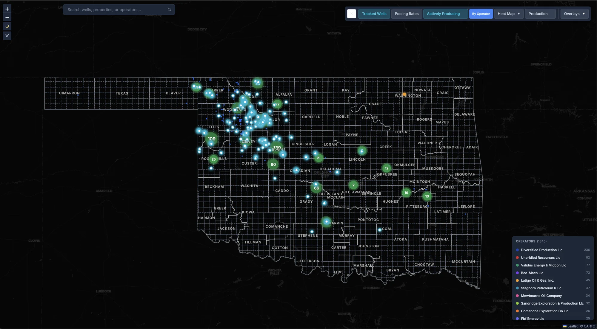
Your Land on the Map
See your properties and wells plotted on the map, with the wells near your land.
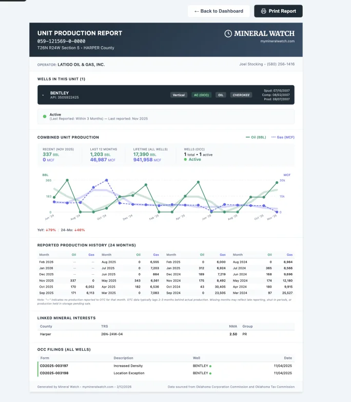
Production Reports
Monthly production for every producing lease in Oklahoma, linked to your wells. Spot trends and verify your royalty checks with real numbers; operator comparison is included with Professional.
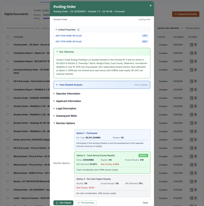
Smart Document Extraction
Upload pooling orders, division orders, and deeds. Our AI extracts key terms, bonus amounts, royalty rates, and legal descriptions automatically.
Everything Connected
Properties link to wells link to documents. No manual organizing — we automatically connect your data so you can find anything instantly.
How Mineral Watch Works
Set up once, stay informed forever.
Map Your Properties
Enter your legal descriptions (Sec-Twn-Rng). We instantly map them and alert you to filings in the sections around your land.
Enrich Your Wells Automatically
Wells are auto-matched to your properties with production data, operator changes, and OCC filings enriched automatically. Track nearby wells and never miss activity in your area.
Analyze Documents & Build Reports
Upload documents for AI extraction of royalty rates, bonus amounts, and legal descriptions. See unit production for every well in your portfolio; printed unit reports are included with Professional.
Your Daily Update
Hi Sarah, here's your daily update with 2 new alerts.
CHARLOTTE 1H-14X
Continental Resources • Blaine County • 12N 08W 14
What this means: An operator has filed a permit to drill a new well on your property.
MW Map →View Details →
PROPERTY
CHARLOTTE 2H-14X
Continental Resources • Blaine County • 12N 08W 14
What this means: An operator has filed a permit to drill a new well.
MW Map →View Details →
WELL
Your Weekly Report
Hi Sarah, here's a summary of 2 alerts from this week.
CHARLOTTE 1H-14X
Continental Resources • Blaine County • 12N 08W 14
What this means: The operator has filed a completion report with the Oklahoma Corporation Commission for this well. The report states whether the well is producing or was plugged as a dry hole; production, if any, typically shows in state records a few months later.
MW Map →View Details →
PROPERTY
BAKER 3-22H
Devon Energy • Blaine County • 12N 08W 22
What this means: The operator has filed a completion report with the Oklahoma Corporation Commission for this well. The report states whether the well is producing or was plugged as a dry hole; production, if any, typically shows in state records a few months later.
MW Map →View Details →
WELL
Your Weekly Report
Hi Sarah, here's a summary of 2 alerts from this week.
GRANDPA JOE 1-14H
Citizen Energy • Grady County • 12N 08W 14
From: Chesapeake Operating
What this means: Operational control of this well has transferred to a new company.
MW Map →View Details →
WELL
GRANDPA JOE 2-14H
Citizen Energy • Grady County • 12N 08W 14
From: Chesapeake Operating
What this means: Operational control of this well has transferred to a new company.
MW Map →View Details →
WELL
Stay Informed Automatically
Daily alerts and weekly digests delivered in plain English — no jargon, no missed deadlines.
Your Minerals Deserve Better
The complete mineral intelligence platform — monitoring, analysis, document extraction, and portfolio management. Start with one property free.
Start Free